
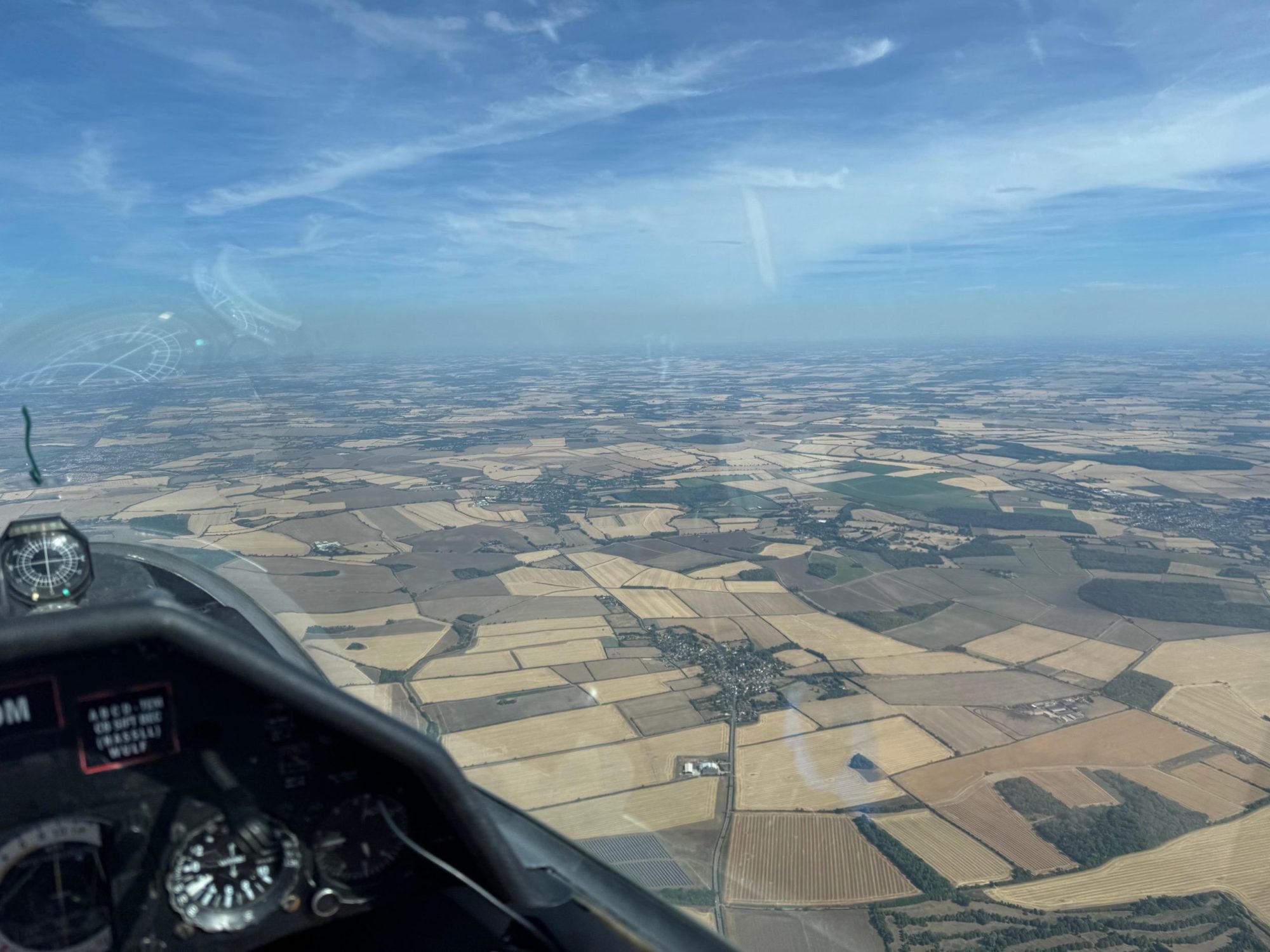
This week I entered my first gliding competition.
Whenever I tell non-gliding people about this their reaction is always “huh?” They don’t understand how we compete in a glider. So here’s the answer.
Again, this was my first ever competition and it was our club’s own “Cloud Rally” competition, so much of this may not apply to proper fancy competitions like the Regionals or Nationals. Plus, I entered in the “funster” low-calorie category, unlike the high-falutin’ “racers”, who faluted considerably higher and faster than I ever will. In any case – here’s how it works.
First, learn to fly gliders. Get all the way through your training so you are a Sailplane Pilots’ License (SPL) holder, which means you’re legally entitled to fly cross-country (XC), just like powered pilots but without those cheaty engine things.
You don’t need to have done a lot of cross-country flights to be able to join in a competition, at least those like our own Cloud Rally. I think I’ve done around 10 cross country flights. To powered pilots that’s nothing, but remember glider pilots rely on very particular weather conditions to be able to do so. In any case, I consider myself an “early” XC pilot, and this competition was very welcoming.
Each day, at 10am, the race director and his team will set a task.
Here’s yesterday’s task:
| Gransden Lodge | 0.00 km | 0.0° | |
| Thrapston | 36.23 km | 309.2° | |
| Towcester | 42.74 km | 229.3° | |
| Bedford Bridge | 35.58 km | 91.6° | |
| Hardwick | 34.20 km | 72.7° | |
| Gransden Lodge | 8.51 km | 243.7° | |
| Total: | 157.27 km | ||
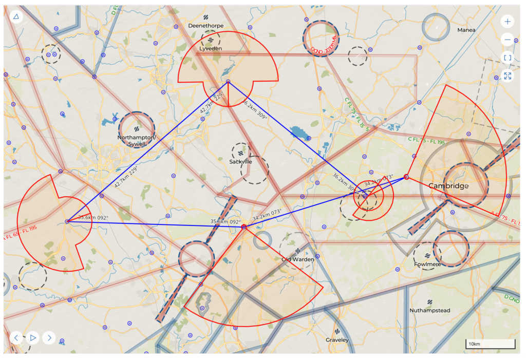
Task setting is itself complex, with analysis of weather conditions, airspace restrictions etc. It involves setting a series of turn points – yesterday, that was Thrapston, then Towcester, then Bedford, then Hardwick. Obviously starting and finishing from our own Cambridge Gliding Club each time.
As a pilot, your goal in the competition is (pretty much) to complete that route as fast as possible. It’s literally a race.
But what a weird race! Obviously, without an engine, to stay aloft you’re reliant on thermals – rising columns of air. So in practice, you find a thermal, circle in it to get as high as you can, and then dash to the next thermal.
Success relies on:
- Luck
- Precise flying to extract energy from thermals – they’re not big, and they’re all trying to trick you
- Tactics about which thermals to pick and where to fly to find them. (Particularly hard on a day like yesterday with blue sky and no tell-tale cumulus clouds or cloud “streets”).
So in practice, here was my actual route yesterday.
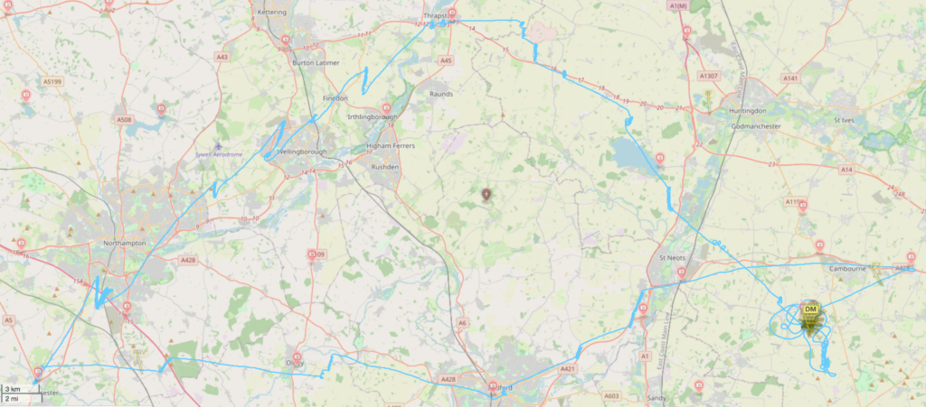
Note the curly lines each time I’m finding a thermal, then a straight line as I dash to the next.
You can see this in the altitude trace:
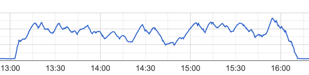
(The highest point on this line is 5300ft above sea level).
Of course, perhaps you won’t find a thermal. Perhaps you’ll need to land out. Not a disaster, but an inconvenience for you and your team, and obviously not a great score. (You then need to be retrieved, typically by loading the glider into a trailer.)
And, I really struggled on this Saturday. The altitude task shows a sad story: for the first half of the task all the way to Wellingborough, I was finding weak-ish thermals, but my overall trend was slightly downwards.
By Wellingborough, I was expecting to need to land. It’s better to land at an airfield if possible. I considered landing at Wold Lodge airfield, and then Sywell. I contacted Sywell aerodrome’s traffic radio frequency so that I was ready to land there if needs be. One of the other gliders on the task was so sure that they’d need to land there that they lowered their undercarriage and got their air brakes out – then found a thermal and climbed away.
I too found a thermal and climbed away – the uphill line at about 14:20.
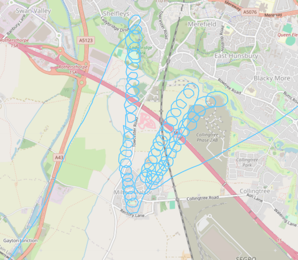
This gave me the height to get comfortably over Northampton. But no thermals materialised over the city, nor south of it. I was down to 2000 feet (1700 feet above ground level). By that point, I was very serious about landing — and this time, there were no nearby airfields — it would need to be in a farmer’s field. I had my eye on a particular field just south of the M1. As the altitude trace shows, though, I scratched around and didn’t actually quite get as far as committing to landing. The thermals there were rubbish. Frankly, I expected better of you, Northampton. Please emit more hot air. At the very least the M1 or West Coast Main Line should have been kicking off thermals, but nope! It was not good.
I continued to scratch around at low altitude – tiring and stressful, given the likelihood of needing to land in a field – and eventually found a weak thermal that got me up to 2700 feet – progress. This allowed me to dart further south again, and this time I found a strong one that got me to 4600feet – and I was back in the game!!
Look at this mess:
From then on it was plain sailing. Later in the afternoon, the thermals were a bit stronger, and as I went south and east I came out from under the hazy top cover clouds which had been impeding the lift. It was particularly delightful to find a strong thermal above St Neots which gave me lots of spare energy and allowed me to shoot back to the finishing turn points at extremely high speed. Fun.
So how did I do?
I came second on that day’s competition. Congratulations to Stuart Haigh the winner of the day! And congratulations also to Team FRV and Team PZ both for safely landing out (one of them just a mile or so from our airfield, the other one pretty much exactly where I’d been struggling around Northampton).
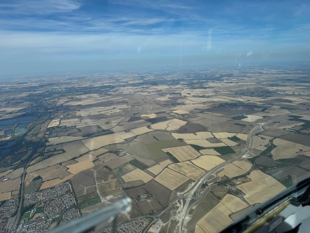
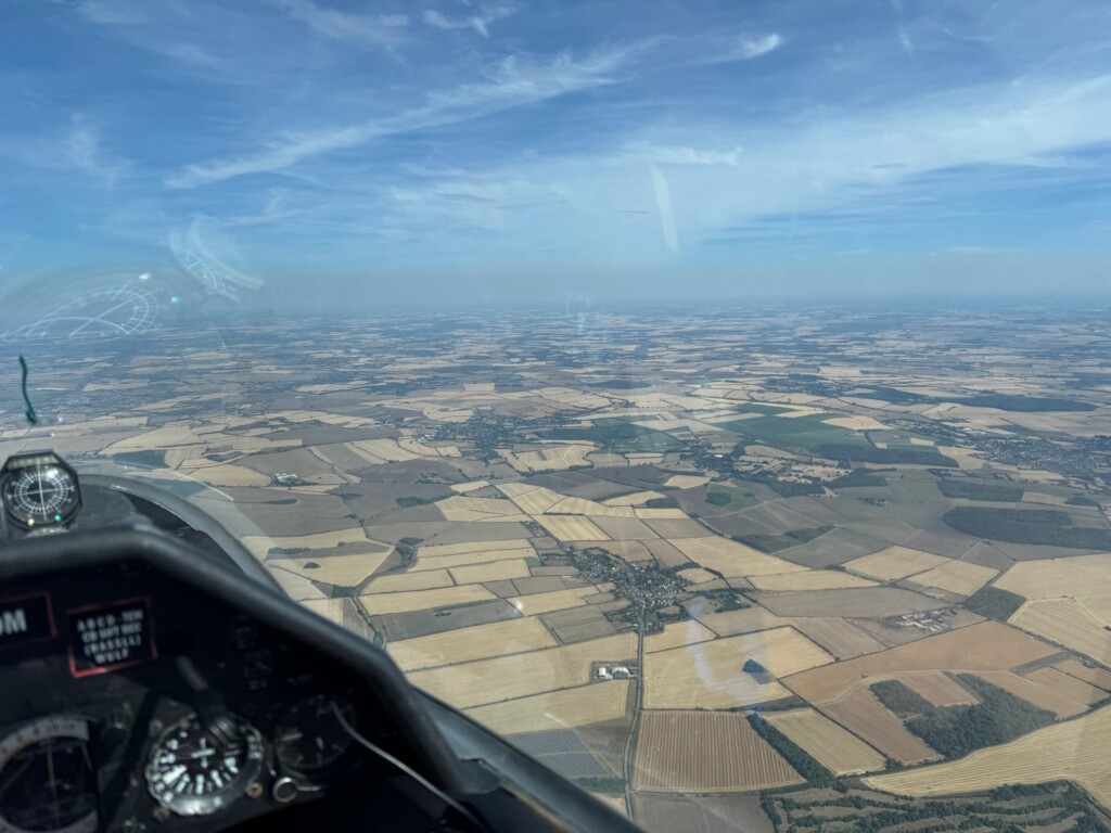
Finally, photos. It was not an easy day. One challenge of gliding is the workload – thermals, choosing places to land if you can’t find a thermal, talking to air traffic control, navigating, and above all, keeping a good lookout. Only on the easiest parts is there capacity to safely take a couple of photos on top of all that – so I took none until back around St Neots. But they’re pretty! Here we go:
Thanks again to the amazing team that put the competition together, and the very supportive gang of pilots who welcome newish XC pilots like me to fly alongside them.
