

A man with a watch knows the time, a man with two is never sure.
Segal’s law
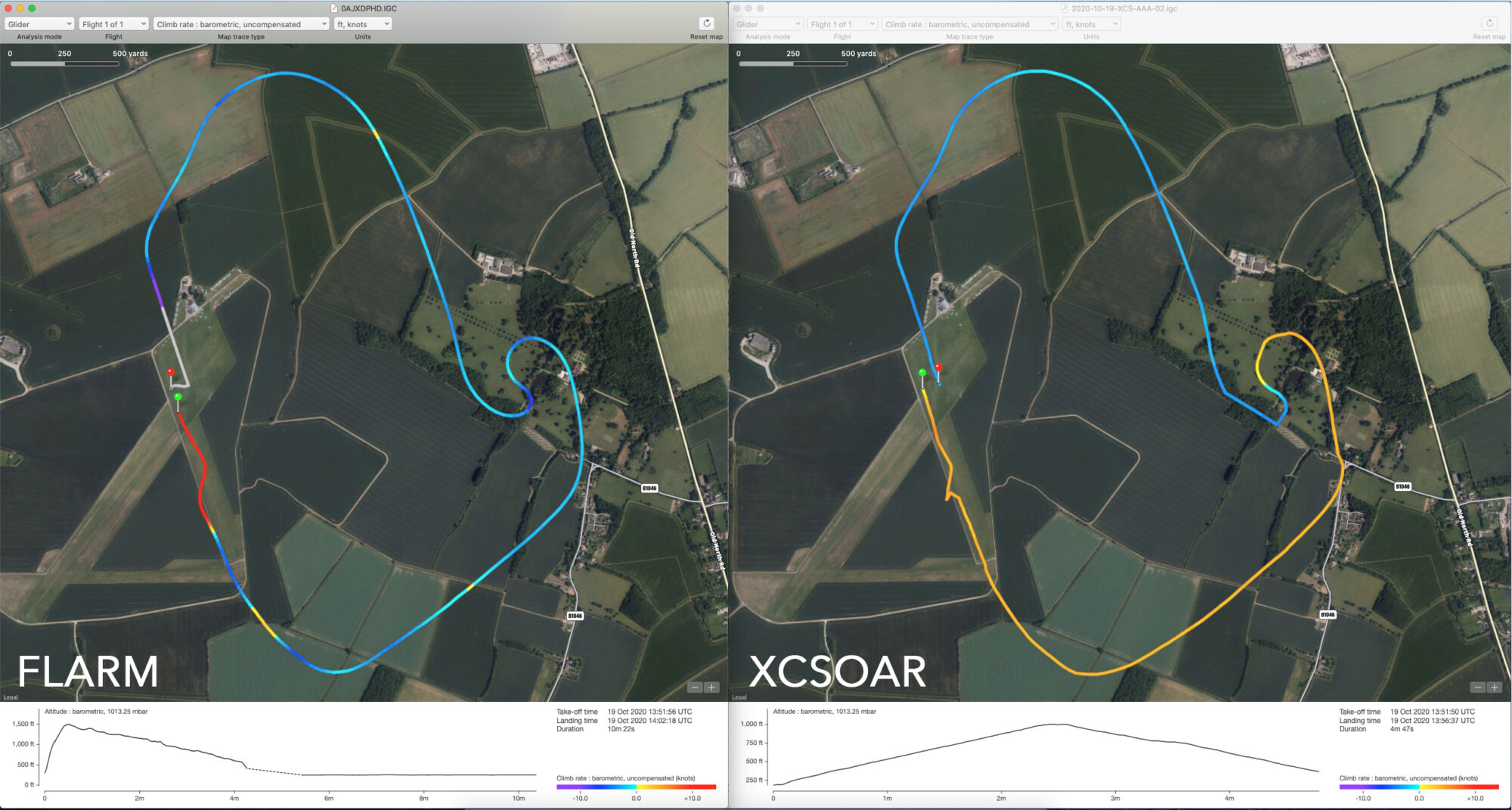
As you would expect the tracking available from FLARM units fitted to all the aircraft at CGC is much better than that from an Android phone, but it’s still an interesting comparison. Both use a combination of GPS and input from barometric sensors. Overall, the phone does extremely well, accurately showing the path of the aircraft around the circuit reasonably well, certainly good enough for navigation purposes. Where it does less well is in the vertical with a long lag in the reported altitude, taking around two minutes to catch up with the launch. XCSoar is showing height increasing all the way round to the two turns over Longstowe Hall when in fact, height is being lost. Looking at the line on the XCSoar graph as it is rising on the left of the graph, it’s a very straight line which leads me to believe that either the phone has a barometer with a limited rate or the software has a rate limit, and that limit has been hit.
Using repurposed tech is great, and one of the things that makes gliding affordable and fun, but it’s good to understand it’s limitations.
